
From 804 to 834 Meters: The Architecture of Redemption
- Nir Topper

- Mar 3
- 3 min read
The western landscape of Jerusalem shapes a foundational Zionist narrative. The thesis of "Narrative Topography" (a term I coined), based on research by Prof. Maoz Azaryahu, Prof. Doron Bar, Prof. Jackie Feldman, and others, reveals how the physical transition between Yad Vashem, the Military Cemetery, and Mount Herzl traces the national journey from "Holocaust to Rebirth" (Shoah ve-Tkuma). These intentional elevation changes are a tangible expression of a redemption that begins in the abyss and culminates at the peak of sovereignty.
At Yad Vashem, located at a relatively lower point on the "Mount of Remembrance" (804m), visitors experience topography through the museum structure designed by Moshe Safdie. The building carves through the mountain; at its end, the visitor emerges onto an observation balcony overlooking the landscapes of Israel—a powerful visual symbol of exiting the darkness into the light of the Land of Israel.
The next step is the Military Cemetery, the essential bridge between catastrophe and sovereignty. Architect Asher Hiram, alongside landscape designer Haim Giladi, created a "Landscape of Sacrifice" integrated into terraces and vegetation, emphasizing life growing from the earth. Here, the military act becomes the functional foundation upon which the sovereign peak is built.
The mountain's summit (834m) is the beating heart of Israel's independence. The reinterment of Theodore Herzl’s remains in 1949 symbolized the realization of the vision and the return of the "Visionary of the State" to his home. The topographical dominance of the peak is a political statement: sovereignty is the ultimate response to the Holocaust. The simple yet striking tombstone bearing only the name "Herzl" anchors the vision that became reality.
The synthesis of space and time is expressed in the national calendar: the dramatic transition from Holocaust Remembrance Day at Yad Vashem (27th of Nisan), to Remembrance Day on the mountain slopes (4th of Iyar), and finally Independence Day at the summit (5th of Iyar). This is a week of re-affirming the national "covenant," physically and consciously climbing from the mourning of destruction and sacrifice to the celebration of pride and sovereignty.
"The Connecting Path" (HaShvil HaMechaber), established in 2003 by the Department of Families and Commemoration at the Ministry of Defense, is the physical manifestation of this narrative. This path links Yad Vashem to Mount Herzl, allowing every visitor to feel the transition from darkness—passing the Cattle Car memorial, Warsaw Ghetto Square, and the fallen soldiers’ plots—to the pinnacle of the State. Walking this route transforms the abstract concept of "Holocaust to Rebirth" into a lived, tangible experience.
👉Join one of my (quiet) Channels - Society, Culture & History:
Telegram: https://t.me/nirtopper
Jerusalem’s topography is a living laboratory of collective memory, where geography serves the Zionist story. It establishes a hierarchy in which the State stands at the top, rising from the ashes of destruction and leaning on its children. Understanding this space transforms the landscape from a piece of nature into the story of a nation’s rebirth.
Image 1: Direction sign to the path connecting Yad Vashem and Mount Herzl, Mount Herzl (Nir Topper)

Image 2: The IDF Orchestra forms a Star of David during the Torch-lighting Ceremony for Israel's 66th Independence Day. The Plaza of Herzl’s Tomb, Mount Herzl. Source: TGT, CC BY-SA 4.0, via Wikimedia Commons.

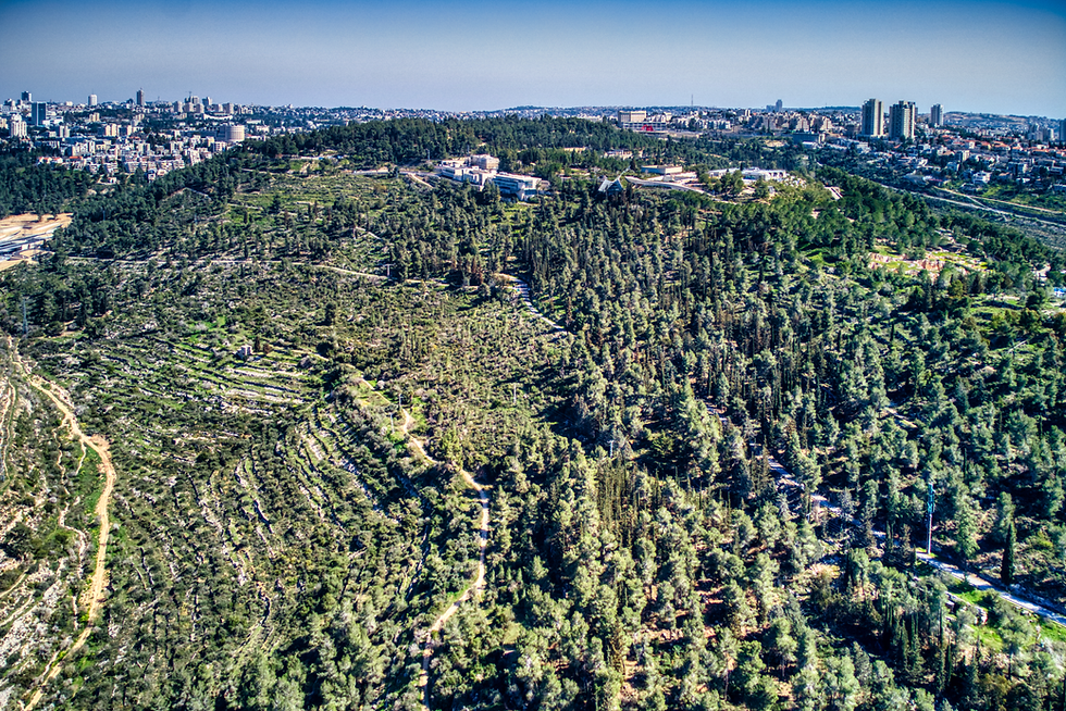
Image 3: Mount Herzl, aerial view. Source: Hagai Agmon-Snir, CC BY-SA 4.0, via Wikimedia Commons.
👉Join one of my (quiet) Channels - Society, Culture & History:
Telegram: https://t.me/nirtopper
--
---
----
#nir_topper #tour_guide #archaeology #history #society #israel #travel #culture #ניר_טופר #מורה_דרך #ארכיאולוגיה #היסטוריה #ישראל #טיולים #תרבות #חברה #MountHerzl #YadVashem #Zionism #Jerusalem #NarrativeTopography #NationalMemory #Remembrance #Herzl #הר_הרצל #יד_ושם #ציונות #ירושלים #משואה_לתקומה #זיכרון_לאומי #LandOfIsrael #IsraelHistory #EretzYisrael


Comments